Saturday, 26 June 2021

Hadrian's Wall, Chollerford to Carvoran via Homesteads


Hadrian's Wall, Chollerford to Carvoran

Thhe next day I was back in Chollerford having driven to Hexham and arked it near the railway station and caught a taxi to Chollerford to restart my walk.

At Walwick, the official route takes three sides of a square to avoid walking alongside the Military Road. I had looked at the map and since it was a long stretch, I was content to take the road option. However given the traffic and remembering that others have been hit by cars, I followed the official route.

Going up the hill, there were several sections of broad wall and distinct ditches.


A section of broad wall.
The ditch in front of another section of wall.
This is a special corner in the wall. Limestone Corner. The perspective is rather hard to.discern but there is a shallow corner in the centre of the picture. This is the furthest point northwards of the Roman Empire (ignoring Antoine's Wall further north started in AD142 but abandoned eight years later).

Just a little way down the hill is Brocolitia Fort. Rather like Vindobala, it is just a bumpy field with nothing to see except for a sign board. However just to the south is the Mithras Temple, a popular religious cult especially with Roman soldiers.
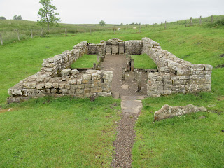
The Mithras Temple. The three square columns at the far end are the three altars that were owned by three local officers from the garrison.

Next was Homesteads, one of the best known Roman forts along the wall. There is a small museum and gift shop plus information boards within the fort itself.

                                      
Me outside the museum before entering the fort itself.
                                      
The old and new entrance to the fort.
The outer facing wall.
Some of the ruins.
More ruins.
The granary.
A general view of the barracks.

 A view over the north wall and the wall as it goes east which gives an idea of the height of the fort above the ground to the north. The wall along this section is built on the Whin Sill, a volcanisc intrusion which dips to the south with gentle southerly slopes but steep northern slopes.


A side view of one of the mile forts.
The archway of the former gate through the wall.
A view of the wall snaking its way up the edge of a hill.
Sometimes the path was a gentle, grassy track.
A lake abutting the bottom of the sill covered by trees with the wall on the left of the trees.
A view of the wall, here the vertical face looks north and the southern side is supported by an earth rampart.
Sycamore Gap, and the most famous and photographed tree in the country, the set for an early scene in Robin hood: Prince of Thieves starring Kevin Costner as Robin and Morgan Freeman as Azeem.

Aseica also known as Great Chesters Fort which had been recommended to me by the staff in Chesters but it was a big disappointment wth only a few courses of stonework surrounding a field.
Against one wall were the outlines of some buildings.

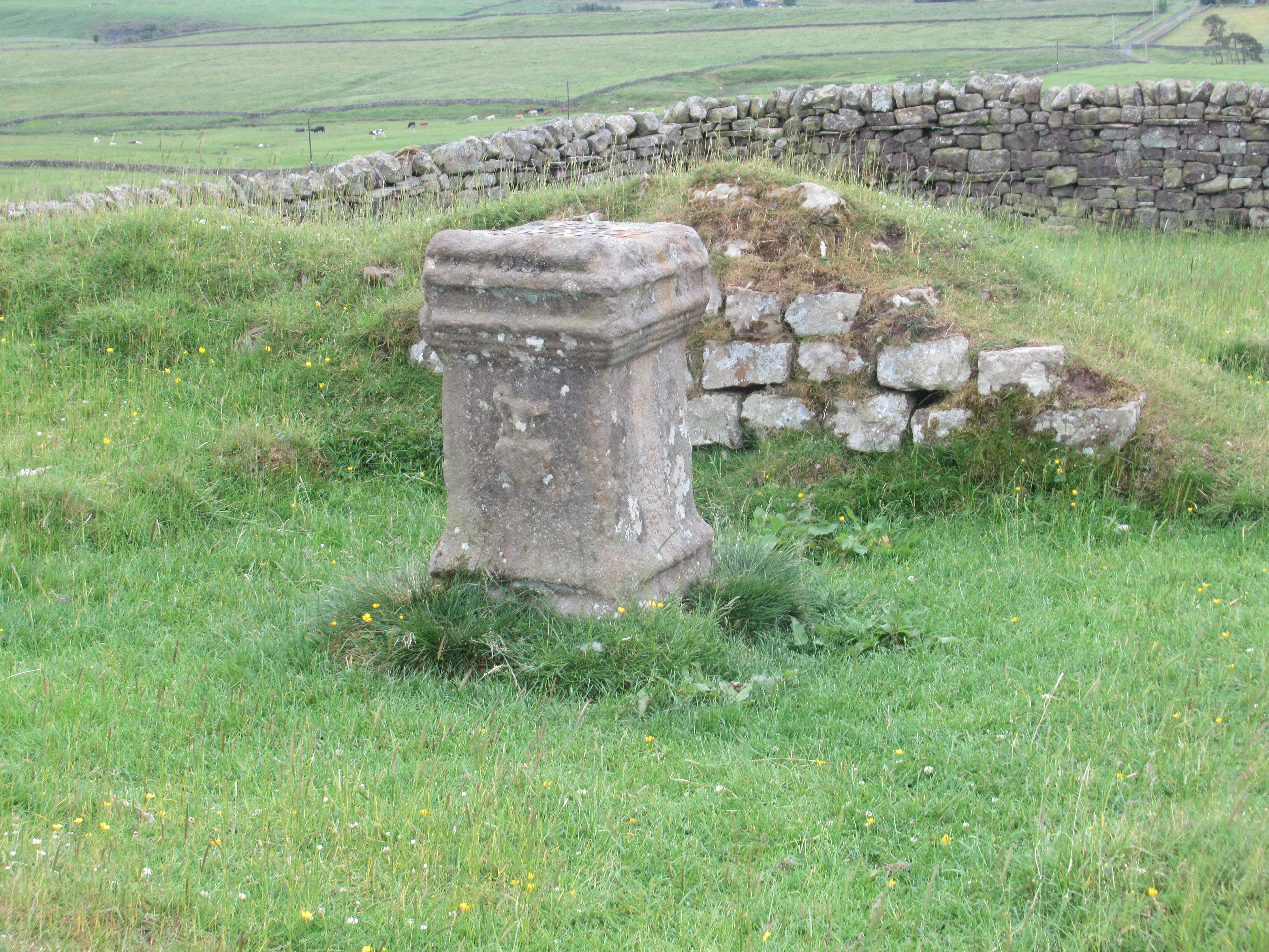
In the south eastern corner as an altar but other than that there was little to see except a bumpy field and curious cows staring at me as I explored the Roman remains.


More wall marching across the sill. 
                                        
Another view of the cliff face of the sill which made such perfect sense to build a border along its line plus a flooded quarry in front.
The ruins of one of many mile forts but the information board shows wht it ay have looked like.
Information board.

At last the end of a long day's walk, looking down from where the sill ends and the wall makes its way down the southern slope to the lake. a former quarry, now the Walltown Country Park and Carvoran.

Looking back at the sill with the wall running along the edge of the top from the country park.

There is little Roman remains to see on Carvoran but there is a Roman Army Museum which I would have visited but the entrance price was high and I didn't have a lot of time left before closing time to make the most of the exhibits so I gave it a miss.


Friday, 25 June 2021

Hadrian's Wall, Vindobala to Chollerford

 Hadrian's Wall, Vindobala (Rudchester Fort) to Chollerford

There isn't much accommodation available en route and even more of a problem at popular times of the year on the trail and moving by car was always going to be a problem as at the end of the days walking, I would have to use public transport to get back to the car and move it on to the next location. 

I had learnt that Wylam was a poorly served station halt so I had parked the car in Prudhoe with more train services and caught a taxi up to Vindobala to restart my walk.

Unlike yesterday, it was cold even for midsummer with a strong wind blowing and wet, sometimes just light drizzle and  occasionally heavy and everything in between. The route follows the Military Road, a dead straight Roman road that follows the line of the wall although there is little wall to see on the first section. The route switches from side to side and sometimes on top of the former bank that supported the wall and sometimes in the bottom of the protective ditch which at least meant that I was out of the wind.

In the car park of the Robin Hood Inn is a plaque to a trekker killed by a car. Most of the route is on footpaths but only a few on the road. Its a straight road and traffic moves quickly so pedestrians have to be alert.


Memorial to Rob Mills.


A tall section of wall which doesn't look like much from the road side but the land falls away on the other side and a man on a horse can't see over the top from this side.

A section of wall which continues to the left but as n=bee replaced by a fence to protect people from walking through the woods and falling into the quarry which has undercut the wall.

Then it was a long slog to Chollerton on the North Tyne River. The route used to cross a Roman bridge to reach the fort of Chesters but that bridge has been washed away and the route takes a diversion to cross the arched 18th century bridge over the river. before returning to teh original route and Chesters Fort.


The bath house down by the river. T
Some pillars supporting the floor for the underfloor heating.

Some bits are well preserved such as these walls standing at two metres high...

...some bits such as these barracks only have a few courses of stonework...


...and some parts are just the foundations.

Then I walked back to Chollerton to get a taxi to the railway station to wait for a train to take me back to Prudhoe where I had parked the car.


Hadrians Wall, Newcastle, Segedunum to Vindobala

 Hadrians Wall, Newcastle, Segedunum


The visitor entre as Segudunum, the last fort on Hadrian's Wall in Wallsend in Newcastle.


The visitor centre viewed from the excavated ruins of the Roman fort. The museum opening hours are 10am to 3pm so unless I was going to loss half a day of walking, I would not see the runs themselves but I had visited before so I didn't feel that I was losing out.

There is not much to see through the fence surrounding the site and only stones poking out of the grass and hence the tall visitors tower to give a better view of the site. There was also a sign on one onf the entrances saying that the museum was shut due to 'enexpected developments'...it was during teh COVID breakout but no specific reason was given.

A stylised Roman centurion acting as security based on a theme from the Angel of the North in rusting metal.

From one side of the site is a collection of stones which are the base of one end of Hadrian's Wall and although I would be walking all day for more than 15 miles, I would not see another section of the wall until the end of the day due to insensitive redevelopment reuse of the stone as a quarry for other project over the centuries.
Just to the south of teh fort are the repaired Roman Baths. 

Along this first section of the wall are several 'benches' made out of sections of re-purposed riveted H beam metal girders but unless you are desparate, the rivets on the top make sitting uncomfortable.
Despite being in a busy city this section is lined with greenery and trees and you might not guess that you are walking through a major conurbation. This is just a glimpse through the trees at a marina on the River Tyne far below.

A metal sculpture of a dinosaur above the trail.

 The trail goes down the steep cliffs facing the Tyne and follows it along the bank through Quayside passing several iconic sights of teh city such as the Millenium Bridge...

...the Baltic Flour Mill....

...and opposite both, a boutique hotel called teh Malmaison, the same name as Napoleon's home, On my previous visit to Newcastle, I had stayed in left hand suite of the two suites at the top of the hotel, each one having one of the odd shaped windows just beneath the company name. 

The iconic low level swing bridge across the river with several other bridges in the background,

An arm of the swing bridge in the foreground and behind is a double decker bridge with a railway on top and teh lower level carries a road.

All along the quayside are things of interest, such as this hanging basket display...


...and various information boards such as this one to Lord Armstrong, a local engineer, industrialist and philanthropist who founded Armstrong Whitworth, noted for their artillery developments and builder of Cragside, the first residence to be lit by hydroelectricity and a fascinating lace to visit. 
After walking along the quayside and through the Tyne Riverside Country Park, the trail makes a steep and long ascent up the side of the valley. This is a view from the top across the Tyne which is out of sight in the depths of the valley.


There was a single Commonwealth War Grave in the local parish church. He was a local lad and served in the Royal Northumberland Fusiliers and stationed in Dover. In October 1939 they joined the British Expeditionary Force in France until they were evacuated from the Dunkirk beaches in a nine day operation ending 4th June 1940. His date of death is 11th October 1940 at which time some battalions were fighting in North Africa but why he is buried here will be a mystery without further research.

On op of the grave stone is a granite pebble with a poppy painted on it.
At last, just 60 metres off the course of the signed trail, late in the afternoon, my first real stretch of Hadrian's Wall, the base of a thick wall with dressed stone out facings disappearing down the slope of the hill. 

I walked on to a fort on the route, Vindobala.

It was marked on the map but it was just bumpy field with nothing to see... except...
                                        
...an informative information board to enlighten the walker that hadn't read his guide book. Someone had spent time and effort in erecting these all along the route to inform passers by, whether they are locals out for a stroll out for a stroll or determined long distance path trekkers.

It was time to get home but there is little accommodation on the route and any day walk often includes  some distance to walk away from the Hadrian's Wall. It was a three mile walk on top of the day's walk along the trail to get to Wylam, the nearest railway station.

I had checked out buses but the times were all wrong, the first and last buses at odd times and for rural areas, some only ran on certain days so unless you had time and money in order to have a few days off to match the timetables, the train was a better option for me. Hence I waked down teh slope to Wylam.


A sign in the village centre.
                                       

It took a bit of searching as other than that single sign, there were no others but I found George Stephenson's cottage in a secluded position not far from the banks of the Tyne North River. Not sign posted but now a bed and breakfast place was Timothy Hackworth's residence, a contemporary and friend of George Stephenson who lived locally who was also an engineer becoming the first locomotive superintendent of the Stockton and Darlington Railway and later designed the Wylam Class of locomotives.                   


The signal box at Wylam station and an iron footbridge in the background. 


Thursday, 10 June 2021

Commonwealth War Grave at the Church of the Holy Innocents in Southwater.

 Commonwealth War Grave at the Church of the Holy Innocents in Southwater.

The inscription reads 'Private H Bennett Royal Sussex Regiment 3rd May Aged 25'.

Commonwealtj grave stones are erected for all combatabts killed in action. Airmen and sailors' graves are common as members of the crew who were killed could be buried in Britain if the captain or pilot could return home or if the ship was in home waters or the aircraft was shot down in home airspace.

Southwater is just outside Horsham where the regiment was based so he was a local lad.


The Falklands Island conflict in 1981 was the first conflict in which families could elect to have the bodies of loved ones returned home. Up to then soldiers were buried in dedicated military cemeteries located near the place where they were fighting, hence the large cemeteries behind the front lines stretching from the English Channel to Switzerland.

There are two questions; if the First World War ended in November 1918, how come this soldier died in May 1919 and how come he was buried in Southwater? All is explained in my book White to Black but publication has been delayed due to COVID.